
Fairview Mountain
Fairview Mountain (2744 m, 9003ft) is situated along the southeastern shoreline of Lake Louise. It was named in 1894 by Walter Wilcox, and the name reflects the view from the top. From Lake Louise the cliffs look intimidating, but the mountain is easily ascended via a trail around the backside on the southern slopes of the mountain. The trail starts in the left corner of the main Lake Louise viewpoint
and goes around the mountain to the col between Fairview and Saddle.
It’s about 3 km to the col, and at some point nice views of Paradise Valley on the left and Fairview on the right open up. We were familiar with this trail from last fall when we summited the Saddle Mountain and then did the loop through Sheol Valley and Paradise Creek. There are some pictures of Fairview from Saddle in that post if anyone interested, and the larches were yellow back then – just awesome. But fresh green larches look nice too.
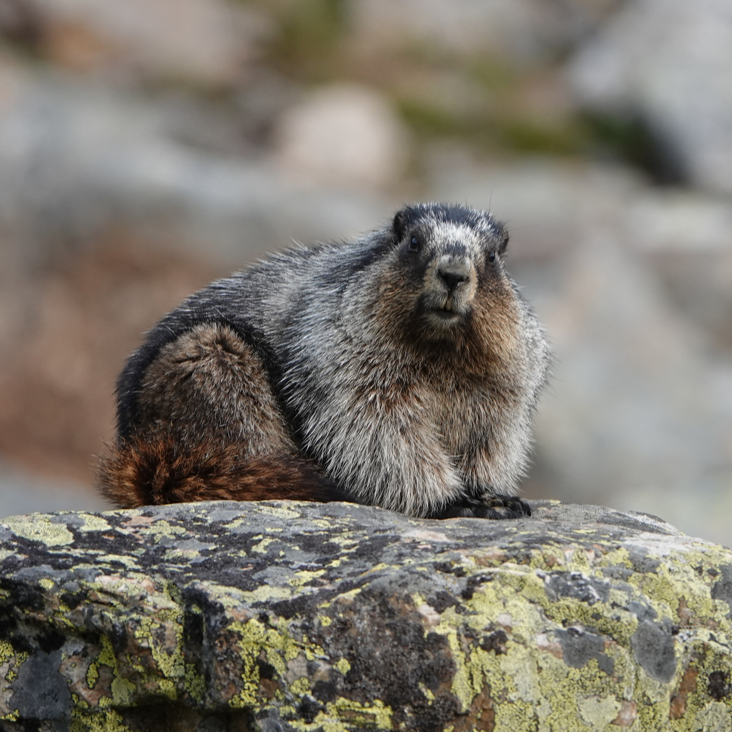
This time we saw a marmot, even two actually, but the second one (on the North end of the summit) disappeared while I was preparing the camera.
I didn’t post any pictures of the valley this time because it was early morning (we got up at 4AM and started around 7 from the upper parking lot which was almost empty by the way), the valley is on the East from the trail, and against the sun the pictures did not look nice. Also, the entire valley was covered with smoke from wildfires. But in the same post about Saddle Mountain there are some nice pictures of the valley.
As a matter of fact, Fairview hike was our plan B. Plan A was Observation Peak, which, according to Alltrails, people apparently already started to hike in this season and reported good conditions. But with all this smoke along the highway we decided to leave Observation for better times because we would not see much from it this time, and to save a 2-hour drive from Calgary we decided to finally take a look at Fairview, because surrounding mountains are not that much far away, as, for instance, Assiniboine from Observation Peak, and we still expected good views even with all this smoke around. And guess what? – we were right.
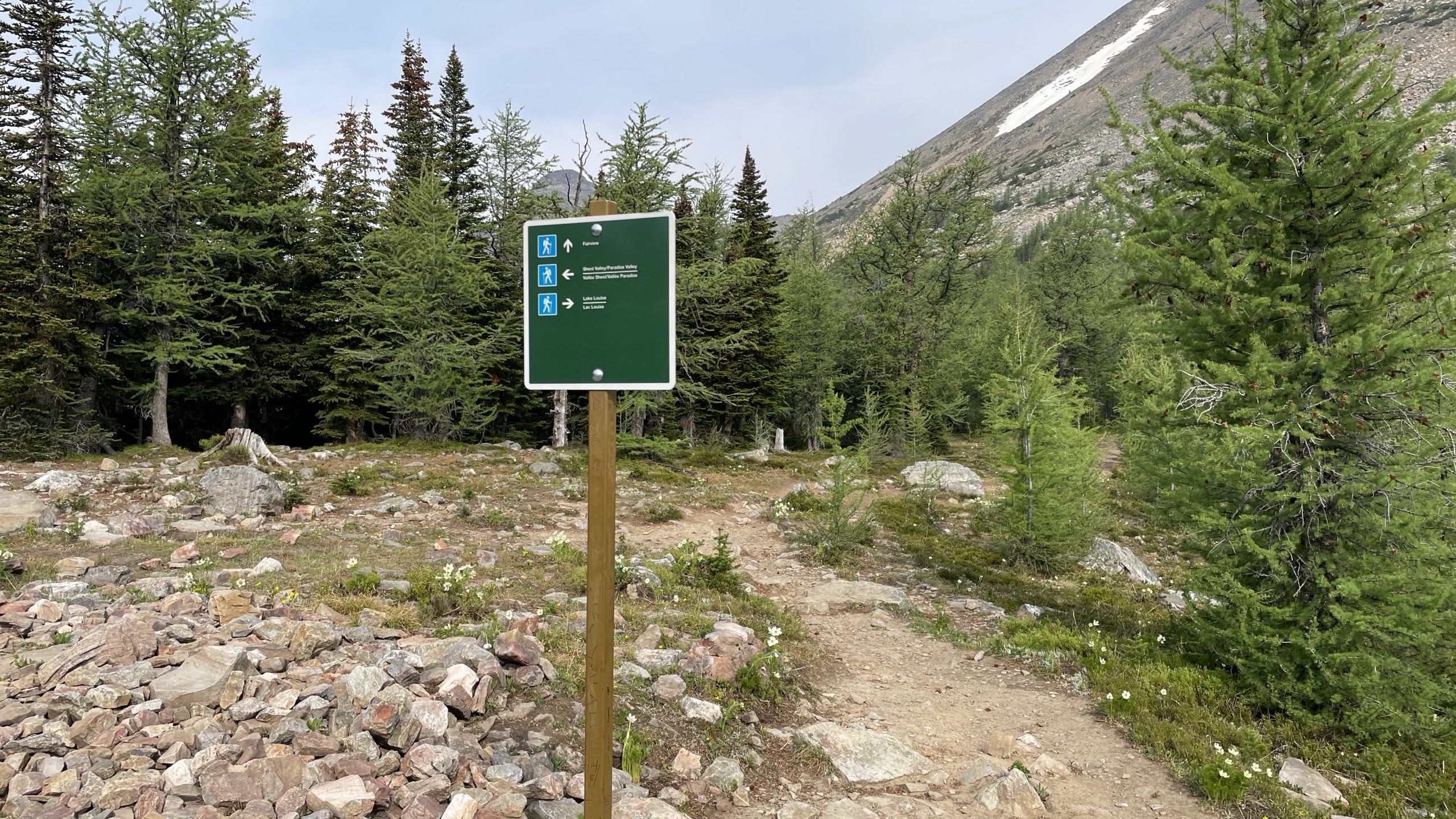
Once you reach the col, there is a sign. Coming from Lake Louise, simply turn left for Saddle, right for Fairview, go straight for Sheol Valley. We took right this time.
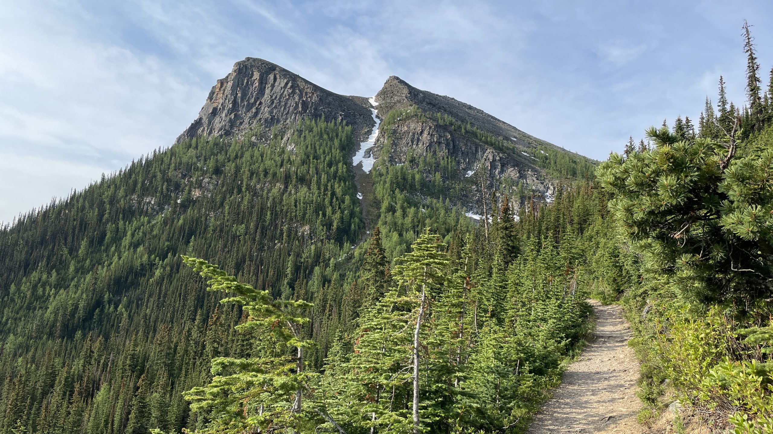
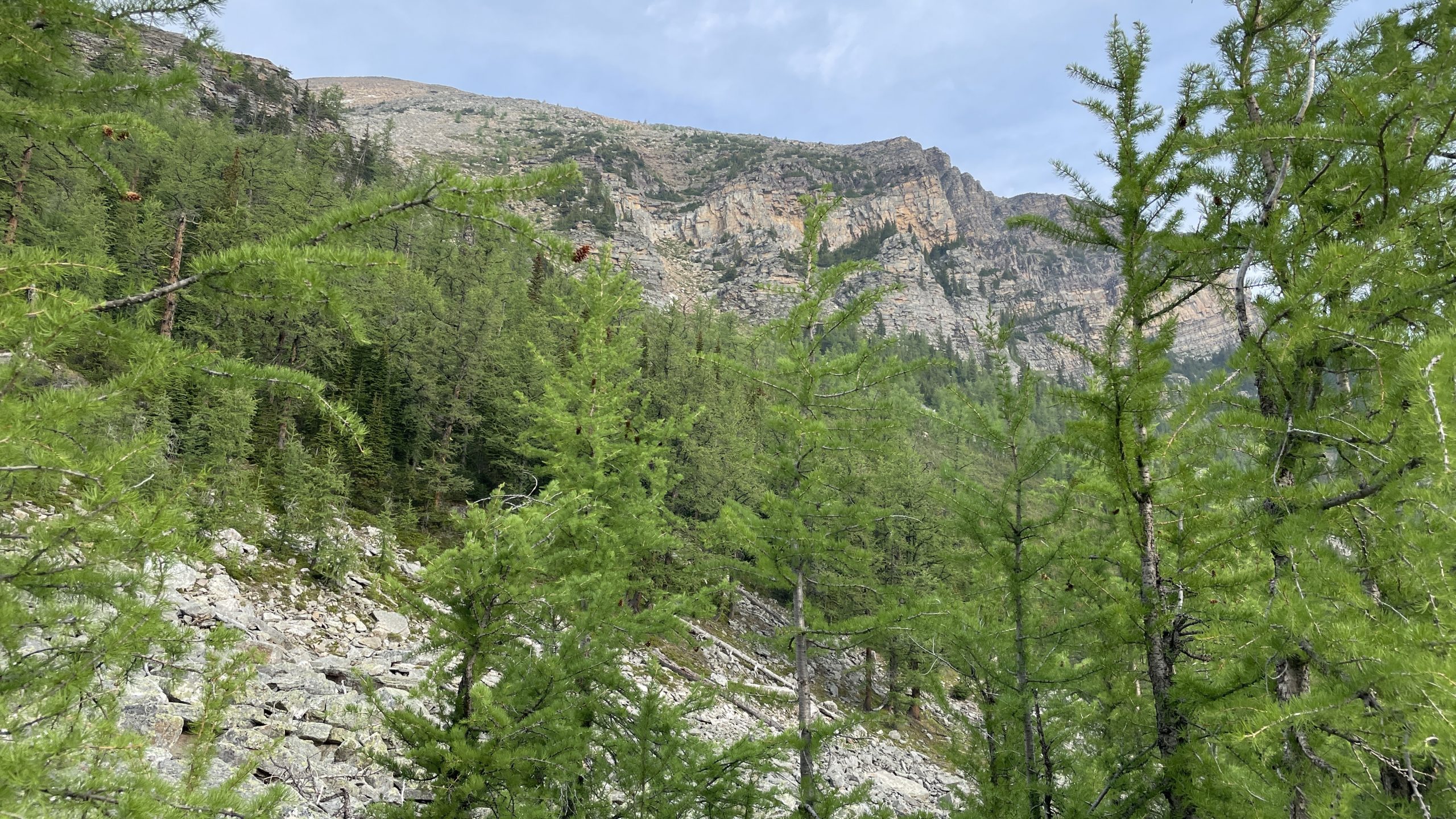
From the intersection at the col the trail goes about 100-200 meters through larches and begins to steadily climb up till the very summit. Sometimes it’s a bit steep, and it was windy this time,
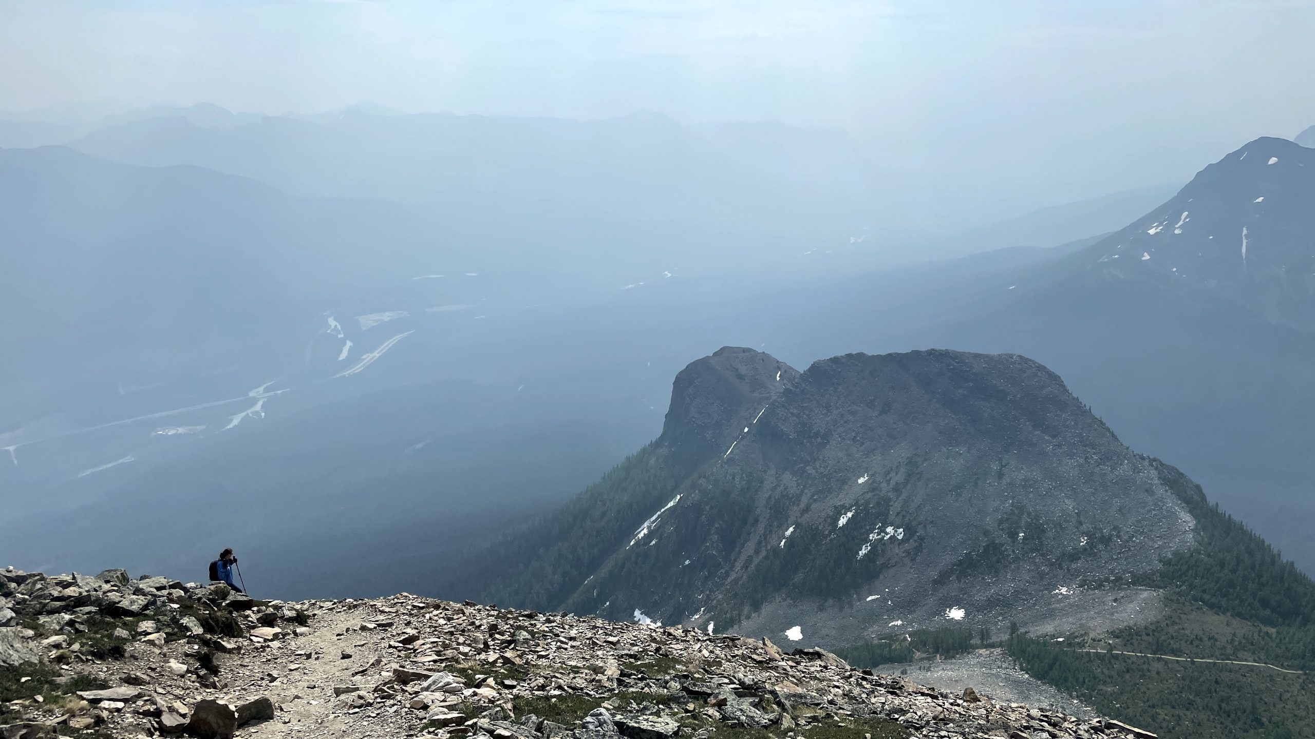
but nothing technical or hard at all. Elevation gain on this remaining 1 km after the col is about 400m, good grip and poles help a lot. If you look back, you see Sheol, Haddo and Temple all the way up
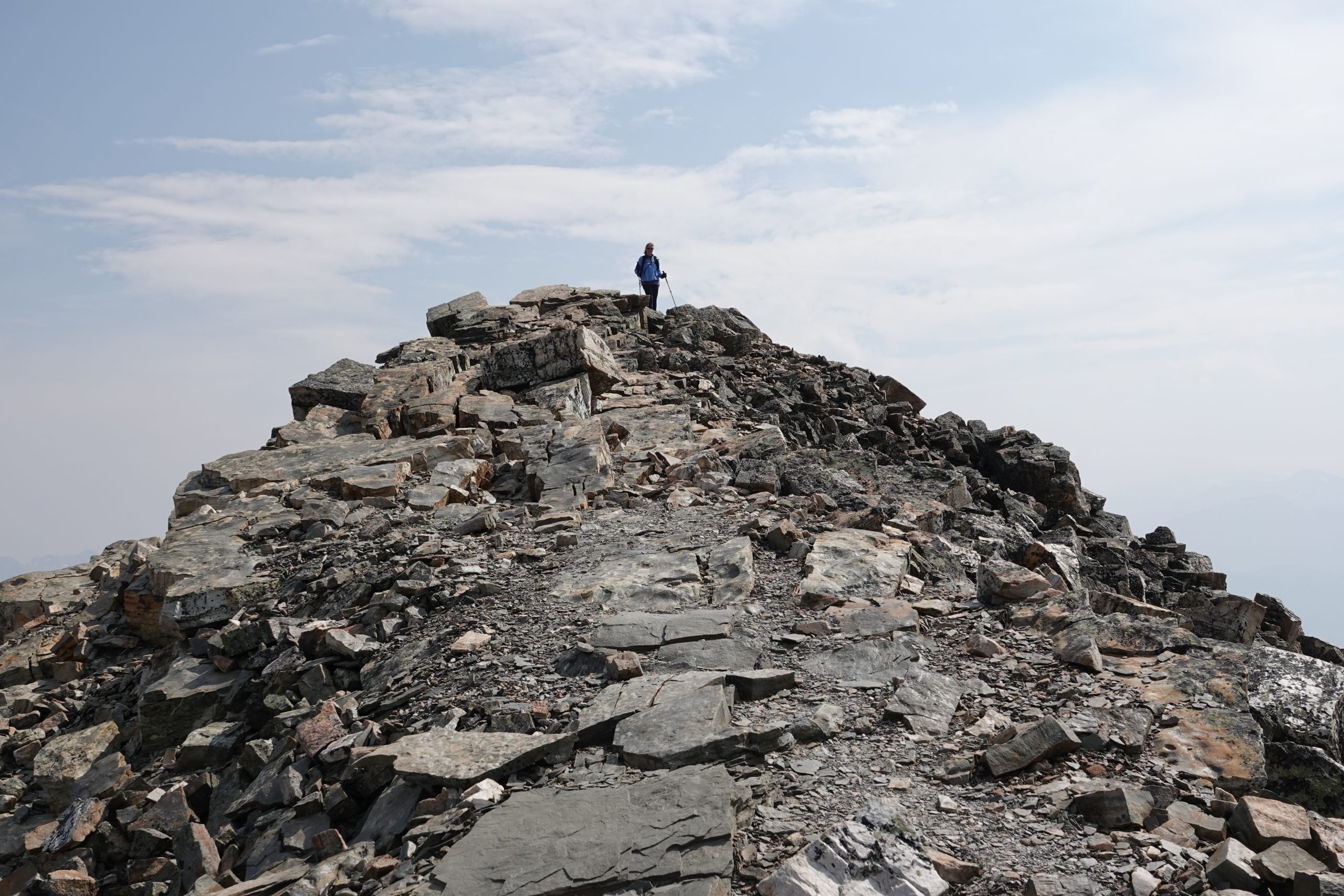
and in about 30 minutes you finally arrive to the summit
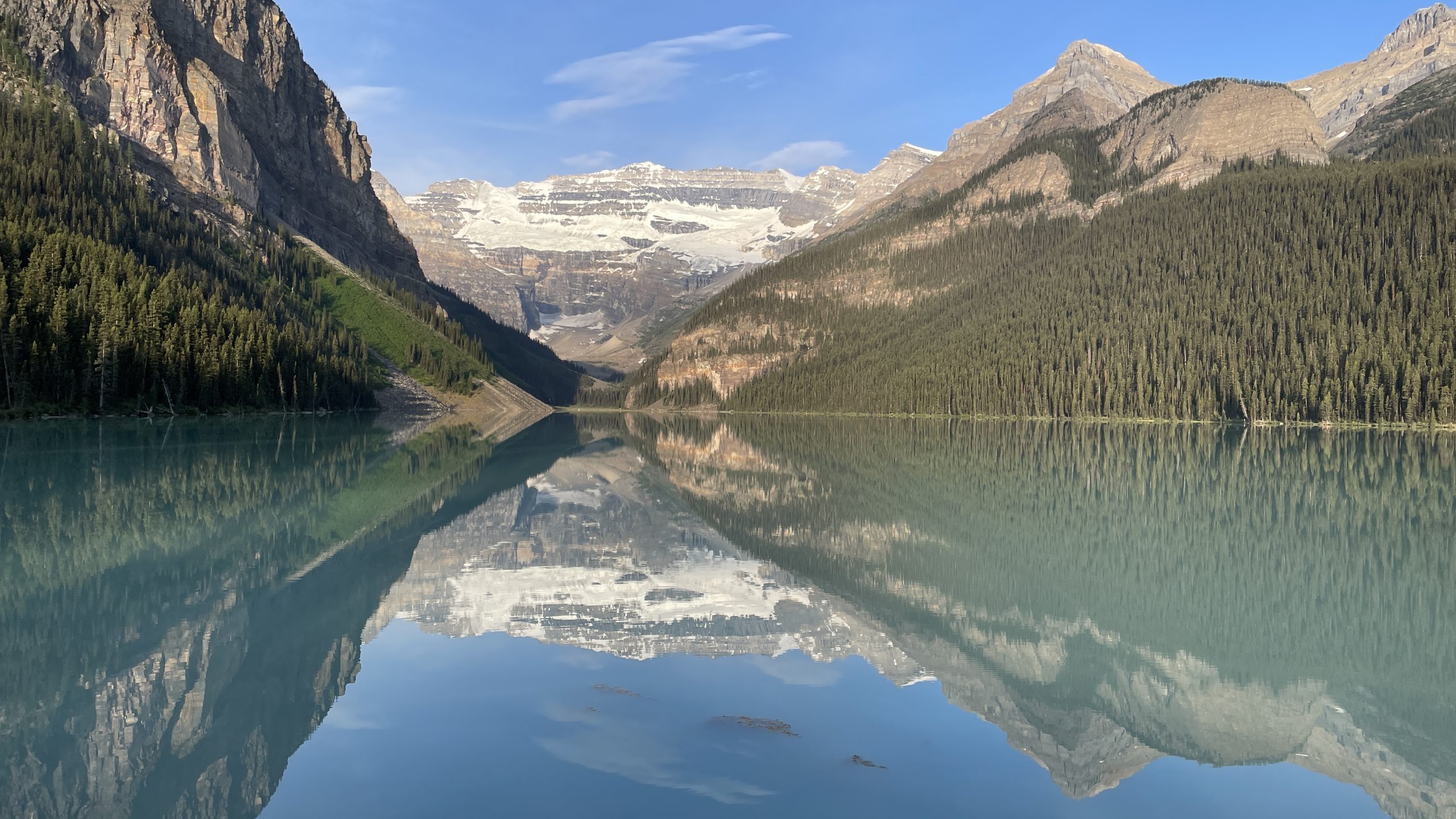
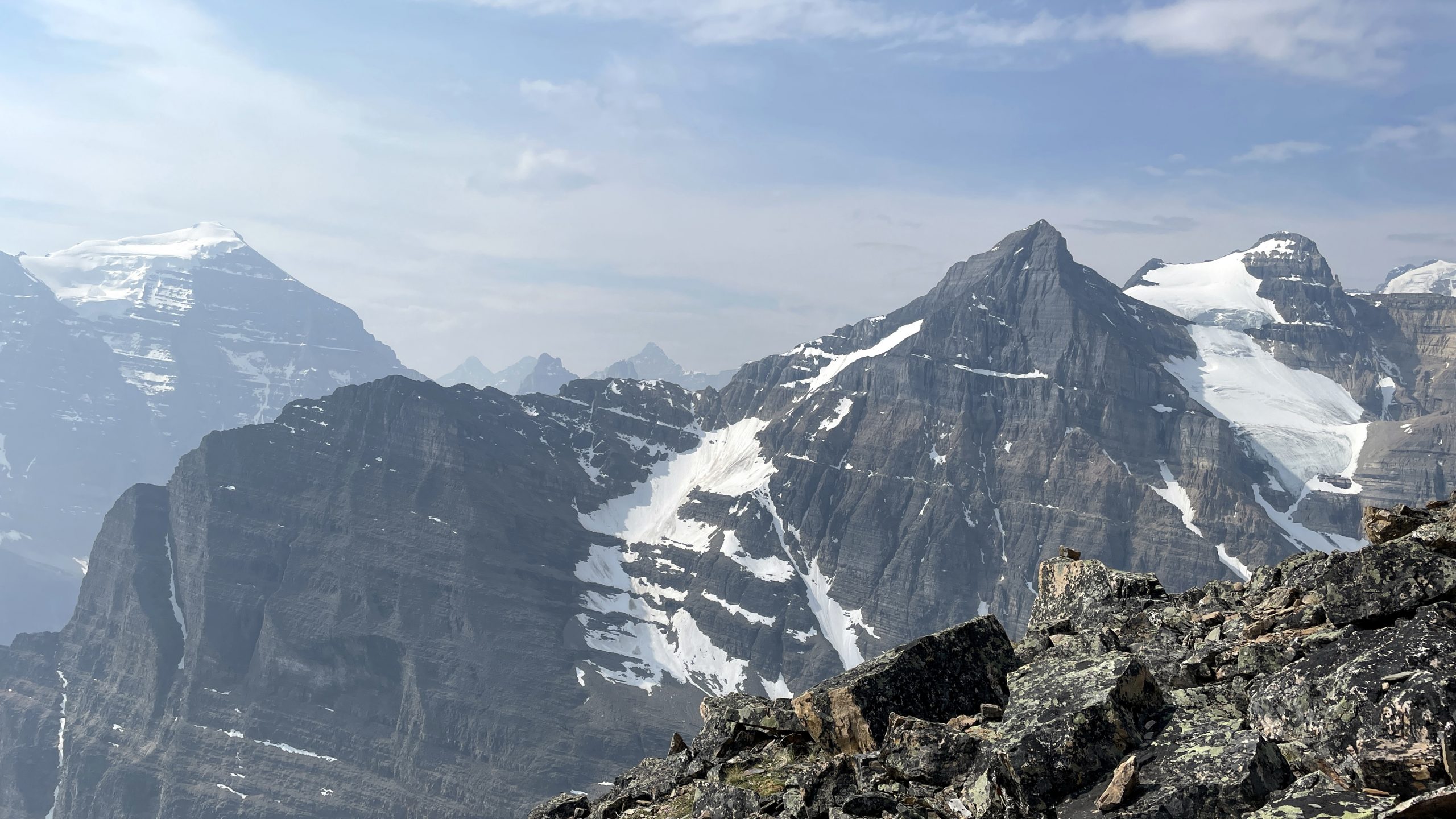
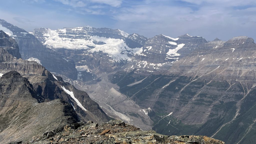
As expected, the views are breathtaking. You see Sheol, Haddo, Aberdeen, Lefroy,
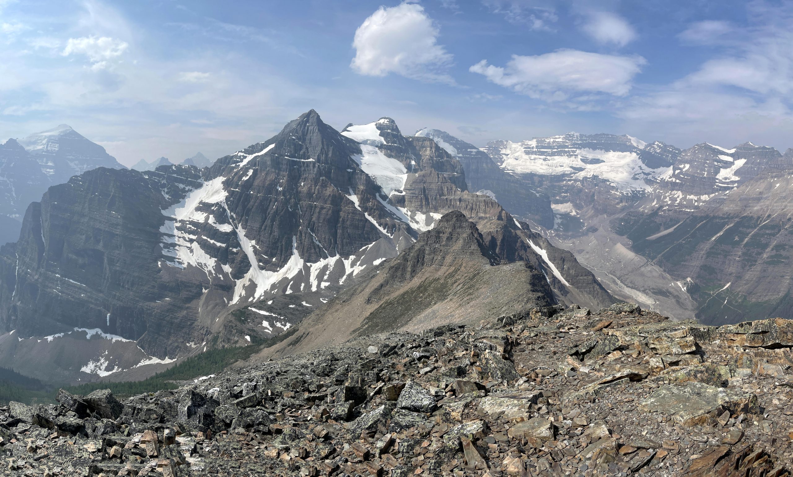
Mount Victoria with Plain of Six Glaciers trail at the bottom of the canyon, leading to it,
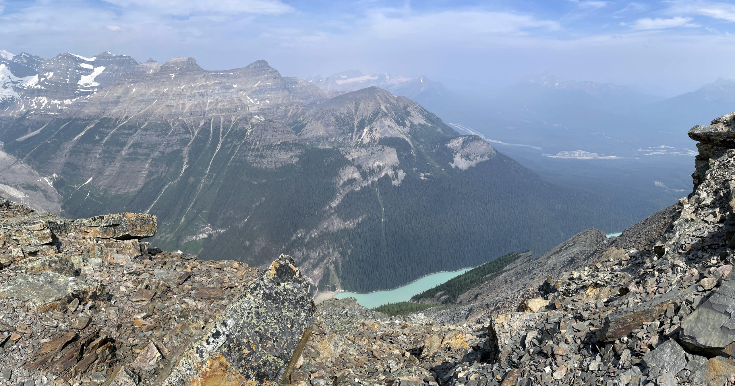
Whyte, Niblock, Saint Piran, Devil’s Thumb, Big and Little Beehives, and even a small piece of Lake Louise
Topographic map: https://opentopomap.org/#marker=14/51.39944/-116.22333
Weather forecast: https://www.yr.no/en/forecast/daily-table/2-5951049/Canada/Alberta/Fairview%20Mountain